 |
|
 07-21-2015, 02:42 PM
|
#1
|
|
Senior Member
Join Date: Jun 2015
Location: --
Posts: 2,392
|
RV route planning
Is there a website or book that will help plan the best RV routes? I'm quickly realizing that the route you would take in a car is often times different than what you would take with a RV.
I ask now before I end up in trouble!
|

|

|
 07-21-2015, 03:08 PM
|
#2
|
|
Senior Member
Join Date: Aug 2013
Location: Bellingham,Wa.
Posts: 6,674
|
Best to tell us where your going and we can tell you about all the wrong turns we made and I'm not kidding.
__________________
2010 Jayco Hybrid EXP21M
2013 Toureg TDI
|

|

|
 07-21-2015, 03:33 PM
|
#3
|
|
Senior Member
Join Date: Jun 2015
Location: --
Posts: 2,392
|
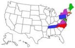
Trip A: Jackson, NJ to Ocean City, MD
Trip B: Jackson, NJ to Kennebunkport, ME
Trip C: Jackson, NJ to Outerbanks, NC
|

|

|
 07-21-2015, 03:34 PM
|
#4
|
|
Senior Member
Join Date: Jun 2015
Location: --
Posts: 2,392
|
Side note, I can't believe there isn't something online saying along the lines of Maine to Florida for RVs. Than at least we can get close before veering off the tried and true.
|

|

|
 07-21-2015, 03:40 PM
|
#5
|
|
Senior Member
Join Date: May 2013
Location: SE Wisconsin
Posts: 3,430
|
Might want to look at a GPS made for this: Garmin RV 760LMT
__________________
Chuck
2013 Jayco Jayfeather X20 E (sold)
2016 Chevy Silverado LTZ 2 Z71 Crew Cab (sold, and dearly missed)

|

|

|
 07-21-2015, 03:41 PM
|
#6
|
|
Senior Member
Join Date: Jun 2015
Location: --
Posts: 2,392
|
I've got that one already. It won't necessarily let me avoid I95 if I'm going south thru DC and what not, unless I haven't figured out the secret.
|

|

|
 07-21-2015, 03:45 PM
|
#7
|
|
Senior Member
Join Date: Jun 2015
Location: --
Posts: 2,392
|
For instance, every website I see has me going over the George Washington Bridge and basically living on i95 from NJ to ME. They're crazy !!! I don't go anywhere near the GWB in my car for heaven's sake !!! I got a motorhome to have a relaxed drive, not have a heart attack on the way !
|

|

|
 07-21-2015, 03:49 PM
|
#8
|
|
Senior Member
Join Date: May 2013
Location: SE Wisconsin
Posts: 3,430
|
Are you avoiding I95 because of height restrictions, or because of traffic?
__________________
Chuck
2013 Jayco Jayfeather X20 E (sold)
2016 Chevy Silverado LTZ 2 Z71 Crew Cab (sold, and dearly missed)

|

|

|
 07-21-2015, 03:52 PM
|
#9
|
|
Senior Member
Join Date: Jun 2015
Location: --
Posts: 2,392
|
Mostly traffic. That and I hate, HATE driving in cities. Driving the 32' motorhome, if I had to do it I'd do it at like 2 in the morning. I hate it that much.
|

|

|
 07-21-2015, 04:27 PM
|
#10
|
|
Senior Member
Join Date: Jul 2014
Location: Fuquay-Varina
Posts: 884
|
I use TYRE on my desktop PC for route planning and posted this thread on it.
__________________

2014 Greyhawk 31FK
2007 Honda Shadow Sabre 1100cc
|

|

|
 07-21-2015, 05:23 PM
|
#11
|
|
Senior Member
Join Date: Oct 2014
Location: SF Bay Area
Posts: 721
|
Good Sam members? Try their route-planning application available on their site. I found it did me well as I searched alternative routes. It let me enter variables for consideration.
__________________
Hattie
"I just go where I'm towed to"
Genealogy Community Social Group Moderator
__________________________________
2015 White Hawk 25BHS w/Outdoor Kitchen
2015 GMC Sierra SLT 2500HD Z71/4x4 Duramax
Son's 2016 Ford F-150 Lariat SuperCrew 4x4 + gifted 1984 Coleman Sequoia Tent Trailer
|

|

|
 07-21-2015, 05:57 PM
|
#12
|
|
Senior Member
Join Date: Jul 2014
Location: New Bern
Posts: 402
|
Stay away from 95 southbound. Take hwy. 1 just south of Delaware memorial bridge. That turns into 113 down the eastern shore of Virginia. No issues at all for campers. Semis go thru all the tunnels. Traffic will be heavy in Norfolk during daylight especially rush hour. But after 7pm you'll be the only One on the interstate. But it's nothing like DC and Baltimore. I drive from eastern NC to Philly twice a month. Use the eastern shore!
|

|

|
 07-21-2015, 06:31 PM
|
#13
|
|
Senior Member
Join Date: Jun 2012
Location: Long Island, NY
Posts: 675
|
Quote:
Originally Posted by Hattie

Good Sam members? Try their route-planning application available on their site. I found it did me well as I searched alternative routes. It let me enter variables for consideration.
|
I tried it yesterday and it routed me on the multiple parkways. I did get warnings about the RV restrictions but it used the route anyway. If it is smart enough to know I can not drive on that road with an RV then why do I manually have to change the route. I can do that on Google Maps for free.
The only difference between Good Sam and Google Maps was the warning notices.
__________________
Thanks,
Brian
TV = 2006 F-350 CC DRW 6.0
TT = 2018 Wildwood 31KQBTS
TT = 2007 Jayco Jay Flight 27bh - SOLD

|

|

|
 07-21-2015, 06:45 PM
|
#14
|
|
Senior Member
Join Date: Jun 2015
Location: --
Posts: 2,392
|
I was doodling w/ Good Sam and felt the same way. Figured I was missing something, but maybe not.
|

|

|
 07-21-2015, 06:57 PM
|
#15
|
|
Senior Member
Join Date: Sep 2010
Location: New York
Posts: 2,210
|
Quote:
Originally Posted by Jopopsy

Trip A: Jackson, NJ to Ocean City, MD
Trip B: Jackson, NJ to Kennebunkport, ME
Trip C: Jackson, NJ to Outerbanks, NC
|
To go to ME from your location and around GWB would cost you 60 miles and 1 hr. Best option is to pick an AM crossing right after rush hour about 9-10 AM as it eases north bound through there. Then you have your pick of alternates. 91 to 84E is a nice hwy and stick to the belts around Boston.
Ocean City is either Cape May ferry to 113 or NJTPKE to 295 then DE1 to 113 as mentioned above. Again timing is key here. You could continue on to OBX from there down onto 13 and CBBT to 64 and towards the shore.
Good Sam routing is good and also a commercial drivers map book. You can cross reference the route agasint the maps to confirm restrictions and it lists every height restriction by state.
I usually use Google maps then move the dot to a highway I want to take to alternate the route. In my vehicle I have a DEZL 560 truckers GPS that has all my info entered for anything that I missed.
__________________

2014 375 BHFS Eagle Premier
2014 Ram 3500 Longhorn DRW CC
6.7 CTD, Aisin, 4.10's
Yamaha EF3000iSEB
|

|

|
 07-21-2015, 08:12 PM
|
#16
|
|
Senior Member
Join Date: Jan 2013
Location: Twin Falls
Posts: 930
|
It's easy enough with any GPS to set your weigh points in advance, then enter one at a time to direct you through or around a city. My GPS allows 2 weigh points at a time, my wife's allows several, I can select the order of each weigh point. One of the biggest mistakes one can make is to actually follow their GPS without having knowledge of the route they will be driving. Use the GPS as an aid, use paper maps and online software to support your choices.
__________________

2011 Dodge Ram 2500 Cummins
2012 Starcraft Autumn Ridge 297 BHS
|

|

|
 07-21-2015, 08:25 PM
|
#17
|
|
Senior Member
Join Date: Feb 2011
Location: Winston Salem
Posts: 272
|
I go that route at night. Stop in NJ rest area to sleep a bit then leave early to beat DC traffic. After that you are home free!!
__________________
2011 32bhds
TV 2002 Excursion 7.3 Few mods ;)

|

|

|
 07-21-2015, 08:39 PM
|
#18
|
|
Junior Member
Join Date: Jul 2015
Location: St. Paul
Posts: 4
|
Truck stop map
We bought a truckers atlas at a local truck stop. It highlights the best routes for trucks (so we figure for rv's too) and gives low bridge warnings for each state.
We looked for online/apps for your very question but didn't find any good answers.
|

|

|
 07-22-2015, 06:25 AM
|
#19
|
|
Senior Member
Join Date: Jun 2015
Location: --
Posts: 2,392
|
Anybody else use a trucker's atlas? If so, which one?
|

|

|
 07-22-2015, 06:35 AM
|
#20
|
|
Senior Member
Join Date: Oct 2014
Location: SF Bay Area
Posts: 721
|
Quote:
Originally Posted by Jopopsy

Anybody else use a trucker's atlas? If so, which one?
|
Yep. Got the Rand McNally laminated (so you can mark it with whiteboard pens then wipe it clean). Did a posting on this just a couple of weeks ago but on my iPad so can't find hyperlink. They (not Amazon) have the best pricing!
|

|

|
 |
|
| Thread Tools |
Search this Thread |
|
|
|
| Display Modes |
 Linear Mode Linear Mode
|
 Posting Rules
|
You may not post new threads
You may not post replies
You may not post attachments
You may not edit your posts
HTML code is Off
|
|
|
|
 » Recent Threads
 |
|
|
|
|
|
|
|
|
|
|
|
|
|
|
|
|
|
|
|
|
|
|
|
|
|
|
|
|
|
|
|
|
|
|
|
|
|
|
|
|
|